

Yesterday I set out on my bicycle, intending to ride to the Echo Canyon trailhead for climb number two. As it turned out, the day was kind of overcast, not a very good day for pictures with my little digital snapshot camera. I was a little tired by then anyway, so I just decided to extend my bike ride and climb the mountain today.
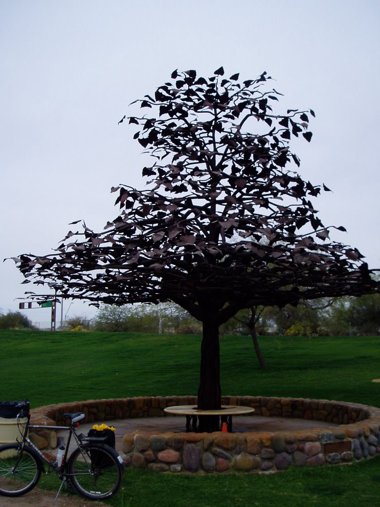
Yesterday, though, I finally took some pictures of one of the neatest trees I've ever seen. This is the Tyler Cisson tree planted in a grassy area along the Salt River bed, just east of the Priest Avenue bridge and a quarter mile or so from the west dam forming Tempe Town Lake. You can actually make it out in this Google Maps overhead image - it's the rounder one on the edge of the grassy area near the upper right corner of the rectangular feature along the river bank.
(In case you're wondering why there's no water in the river, it's because in Phoenix that would be a flood.)
Here's what the Tyler Cisson tree looks like from the ground. It provides a very nice, shady area to rest in during the heat of the summer.
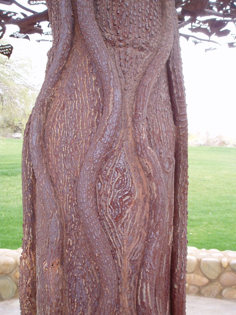
The Tyler Cisson tree has a trunk well suited to its environment, with unusual veins serving a purpose I'm not sure of, and a rugged bark befitting its harsh environment.
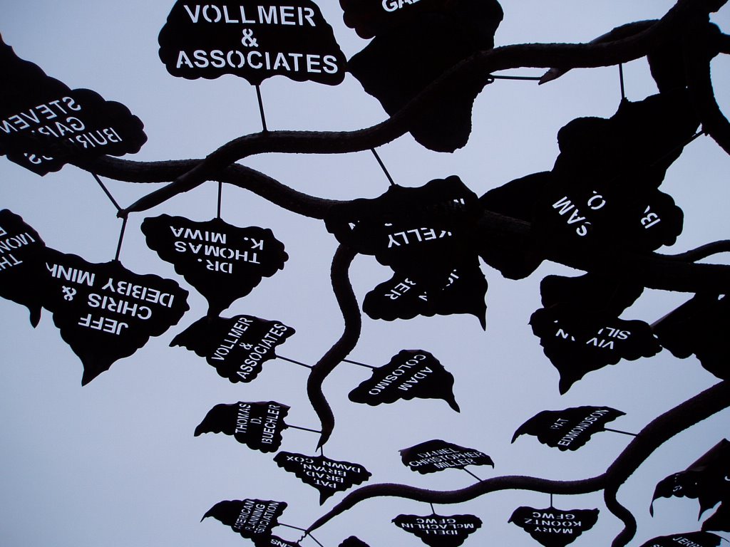
The Tyler Cisson tree has very unusual foliage, too, allowing just enough sunlight to penetrate the tree's thick canopy.
Credit where credit is due:
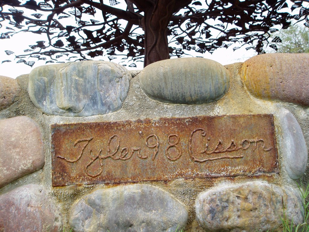
I think Tyler Cisson created a pretty neat work of art out there all by itself. I hope he's enjoying artistic success today.
But back to this morning at Camelback Mountain.
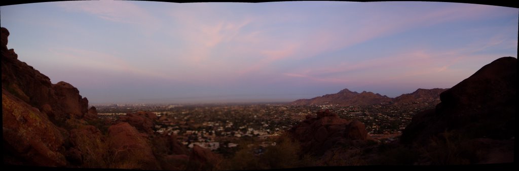
The climb took me twice as long this time, but I was in no hurry, stopping to take pictures and enjoying the scenery. I started up the trail shortly before sunrise with enough light to see the trail and some pretty colors in the sky.
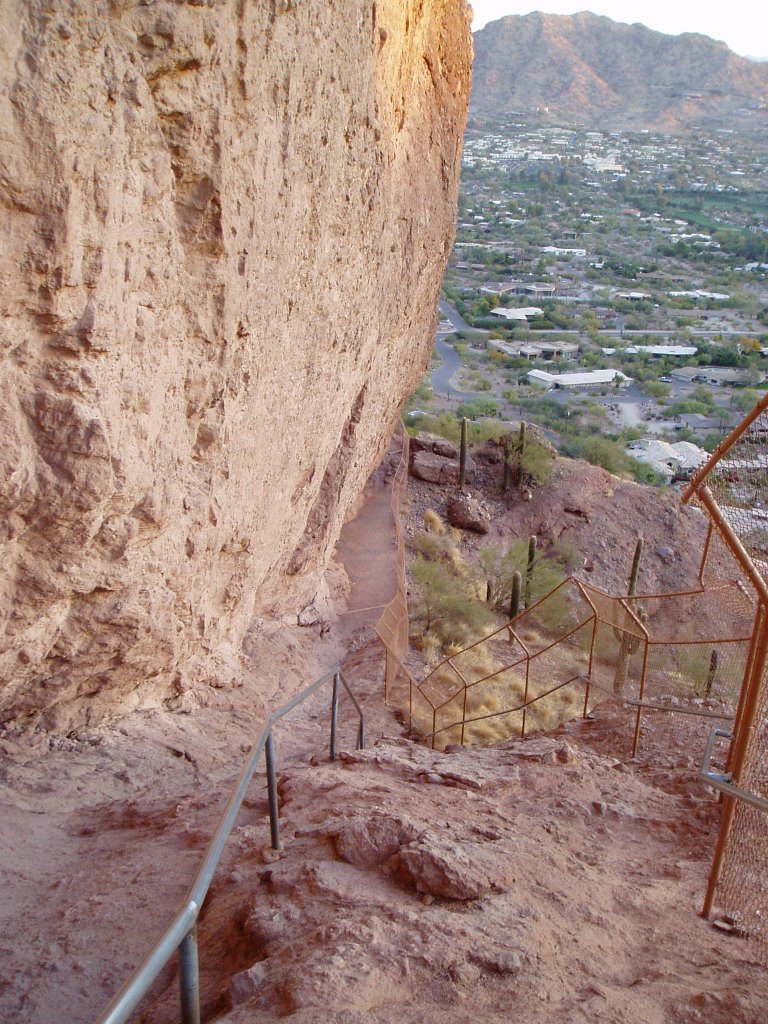
As you walk up the trail you come to a more challenging section to which I am unable to do justice with the camera. This view looking back toward the trailhead has been taken by many people, and mine doesn't convey the steepness either. The grab bars are there for a reason, as the caption on a similar picture at Flickr states.
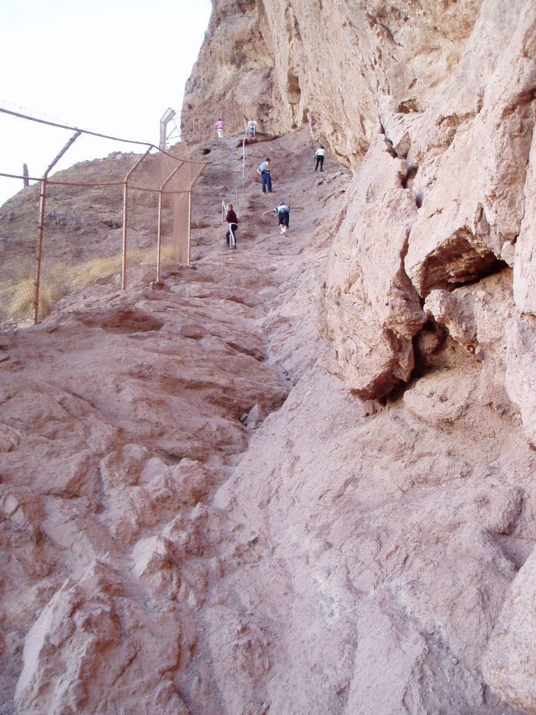
This shot looking up the trail might provide a better sense of scale if not steepness.
As the pictures above may show, there's a bit of a rock overhang above the trail. Here it is again, this time looking down the trail from above.
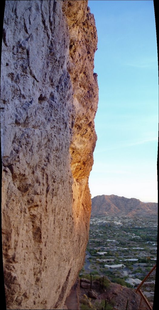
The picture above again doesn't convey the scale of the thing. You might be able to make out the trail at the very bottom of the picture after looking at the enlarged section below, which shows the trail underneath the rock overhang, bordered by an 8-foot cyclone fence. You can use the upward pointing sharp feature at the bottom to mentally superimpose the enlarged section on the bigger picture.

I'm sure it's no big deal to some people, but that section of trail impresses me.
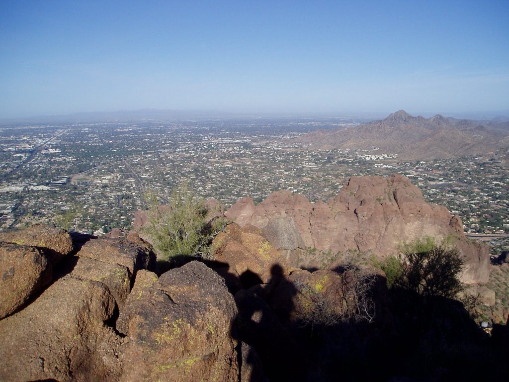
Viewed from the summit of Camelback Mountain, Barnes Butte and Papago Butte (in the area I normally take my weekend walks) seem wimpy. Papago Butte is on the left, Barnes Butte on the right. Barnes Butte is off limits, behind the Arizona National Guard base fence. The Arizona emergency preparedness bunker is supposed to be under Barnes Butte, right across the street from my house, which is on the plainly visible boundary this side of the buttes in the picture below. It's not shown, but off to the left Papago Park continues to the Desert Botanical Gardens and the Phoenix Zoo.

You can get some idea of the layout of the area from this Google Maps shot. The golf course in the middle of the picture is a good reference. Camelback Mountain is just north of the golf course; Papago Park is south.
Well, I guess that's enough. I'll just end with a snapshot from the summit of Camelback looking west. I think that's Squaw Peak on the right.
I climbed about half way up Squaw Peak with my son on my shoulders a few years ago. Now he's 16 and the only way he'll go with me is if I do the same thing again! ;>) Maybe I'll climb Squaw Peak next week.
I'm still not used to it, but Squaw Peak was renamed Piestewa Peak a few years ago in honor of Lori Piestewa, a Native American soldier who died in Iraq (in the same ambush in which her friend Jessica Lynch was captured by the Iraqis). There is some controversy about the renaming of Squaw Peak to Piestewa Peak, something about the term "squaw" being vulgar to Native Americans and reactions by some who don't like political correctness or how it was enacted in this case.
OK, Piestewa Peak next week! Onward and upward!
3 comments:
Dude! It's a fake tree! I was suckered. It's a nice tree too. Those things were meant to be vines, not veins. Do you have any vines out there?
I'm jealous again. Nice pictures too. I like that rough hill in the middle of a flat plain.
Well, another couple of weeks and I'll be able to get my bicycle out. I won't be able to ride it until the ice floes start to break up of course. At least I don't live in Minnesota.
Thanks.
My Fairbanks sister-in-law mentioned that people up there ride all through the winter.
OK. I know I'm a wimp. Once upon a time, I actually commuted on my bike through the winter. Ice on the roads would sideline me, but not snow. I used a balaclava for the cold air and treaded tires for the snow. It can be done. Now I'm getting a little too "mature" for that sort of thing. Though a dog sled would be cool. At least it's closer to the ground.
Post a Comment